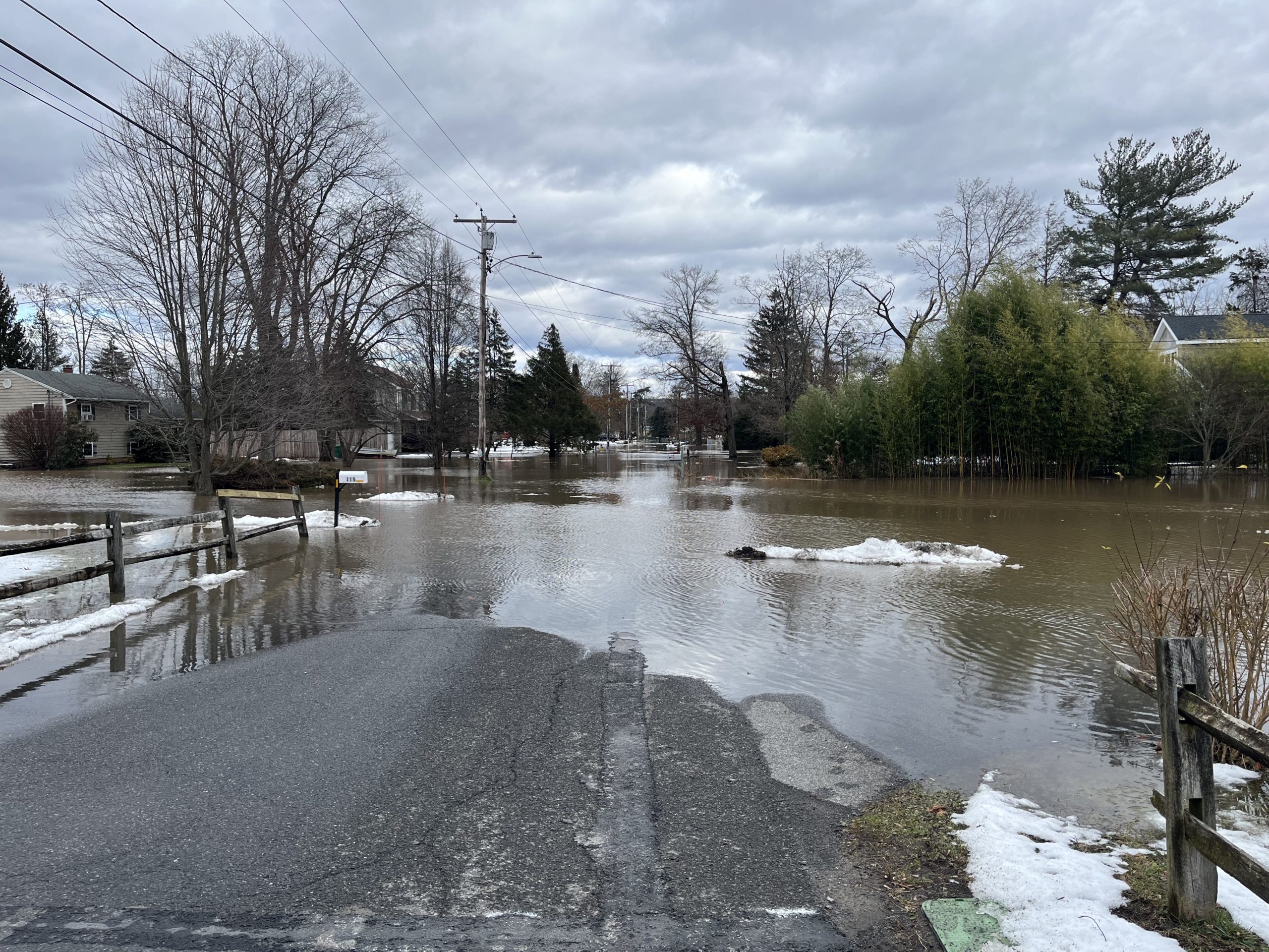
The deadline to submit comments on the draft Lower Esopus Stream Management Plan has been extended by a week until Monday, January 22nd.
To read the draft SMP and access the comment form, visit https://loweresopussmp-ulstercounty.hub.arcgis.com/
The deadline to submit comments on the draft Lower Esopus Stream Management Plan has been extended by a week until Monday, January 22nd.
To read the draft SMP and access the comment form, visit https://loweresopussmp-ulstercounty.hub.arcgis.com/
NYCDEP said it is prepared to shut down the release channel when the Lower Esopus water level rises. The Interim Release Protocol (IRP) stipulates shut down of release channel when creek level is within 1 foot of the “Action Stage” (18′) and is forecasted to reach “Action Stage”, as predicted on the National Weather Service forecast for Mt Marion stream gauge.
The Mount Marion forecast from the National Weather Service predicts the river stage to reach action level overnight Tuesday and peak near 19.9 feet by noon on Wednesday, January 10th.
The Ashokan Release Channel is continuing to operate at its maximum rate of 600 MGD (928 cfs) today and has been operating at this rate since December 22. Ashokan Reservoir storage peaked on December 22 at 99.4% and has been on the decline since. Ashokan Reservoir storage is currently at 93.9%, and the turbidity of the water in the release channel is 15.9 NTU. The Catskill Aqueduct is online and diverting 550 MGD for water supply. The release channel is prepared to shut down when water level reached 17 ft at Mt Marion stream gauge.
For the latest information see the Mt Marion stream gauge.
The draft Stream Management Plan is available for review and comment at: https://loweresopussmp-ulstercounty.hub.arcgis.com/
Please use the comment form on the website to submit comments and feedback on the draft Plan. The comment period will be open until Monday, January 15th.
The Ashokan Release Channel has been reactivated to draw Ashokan Reservoir storage toward the Conditional Seasonal Storage Objective (CSSO) now that the Mt. Marion gauge has dropped below the action stage of 18 ft. After the shutdown during the storm event, NYCDEP will increase the Ashokan Release Channel from 0 MGD to 120 MGD (186 cfs) starting today in a series of steps.
Ashokan Reservoir storage is 97.3% today, the CSSO is 90.0%. Turbidity of the water in the release channel is 1.7 NTU.
The Natiional Weather Service forecast for the Mount Marion gauge predicts that the stream level will continue to decrease over the next 72 hours.
Additional adjustments may be made to releases in repsonse to reservoir and weahter conditions pursuant to the Interim Release Protocol.

On December 18, 2023, the water level at Saugerties (Turkey Point, Hudson River tide gauge station) peaked at 5:24 PM at 8.0′ above MLLW. This was 4′ above the normal high tide. The high water was driven by a combination of tidal surge and run-off from rainfall totals of 3.5 to 4.5 inches. By comparison, winter storm Elliot (bomb cyclone) on December 23rd, 2022, reached a slightly higher level of 8.3′ above MLLW, was primarily surge from the ocean, and unaccompanied by much precipitation. Note that the level of water in the tidal Esopus Creek when the tide is high is minimally affected by the shape or depth of the channel bottom. No matter how deep the channel is, the tide reaches an elevation established by the water surface elevation in the Hudson River.
The first draft of the Lower Esopus Stream Management Plan is ready and available for public comment. Please click on the link below to view the draft stream management plan and complete the survey to provide your comments on the plan.
NYC DEP shut down the Ashokan Release Channel just after 6:00 AM this morning, December 18th. This is due to the Mt Marion USGS gage reaching 17 ft (1 ft below action stage). The flow was reduced from 309 cfs to zero. The release channel will stay closed until the Mt Marion water level falls below action stage and reservoir conditions are assessed. Ashokan Reservoir storage is currently at 90.5% with a 10.9 BG void.
For Monday, December 18th, the Stevens Flood Advisory System is forecasting a storm surge of 3 to 4 feet atop the evening’s high tide, which may cause moderate flooding along low-lying waterfront properties. High tide along the tidal Esopus Creek in Saugerties will be 6:15 PM. The water level may reach or exceed the Moderate Flood Level of 7.2′ above Mean Low Low Water (MLLW). By comparison, last year’s winter storm Elliot on December 23rd, was at Major Flood Level and reached 8.3′ above MLLW. Although lower than last year’s storm tide, it will likely enter yards on Lighthouse Drive and Ferry Street in Saugerties.
Tivoli Bays South (and Saugerties)
Stevens Flood Advisory System:
To receive alerts, register for email flooding notifications from the Stevens Flood Advisory System.
December 5th, 2023
Join Ulster County for a community walkshop—a walking workshop—at the Marbletown Town Park to discuss the Stream Management Plan for the Lower Esopus Creek. Share your thoughts and input to help shape the Plan, which will be a guide to protect and enhance the creek.
WHERE: MARBLETOWN TOWN PARK
350 Tongore Road, Kingston, NY 12401
WHEN: THURSDAY, AUGUST 31, 10:30-11:30 AM
Rain or shine
(in case of severe inclement weather the event will be held on Thursday, September 7)
Please register in advance (recommended but not required)